
Landkarten
Die Liste enthält 199 Einträge. Suchergebnisse löschen und Gesamtbestand anzeigen.
| Abbildung |
Beschreibung Stichwort, Autor, Titel, Buchbeschreibung |
Preis EUR |
|
|---|---|---|---|
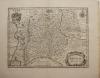 |
Grafschaft Erbach: Odenwald. Hessen: Blaeu. Erpach Comitatus. Kupferstich von Blaeu, um 1650. Engraving by Blaeu. 35,5 x 48 cm. Gut erhalten. | 100,-- |  |
 |
Texas: USA: Johnson´s new map of the state of Texas. Kolorierte Lithografie bei Johnson und Ward in New York erschienen. Coloured lithograph published by Johnson and Ward in New York, 1864. Blattformat: 67 x 46 cm. Gut erhalten. | 280,-- | |
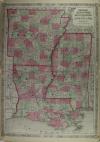 |
USA: Arkansas: Mississippi: Louisiana: Johnsons Arkansas, Mississippi and Louisiana. Kolorierte Lithografie bei Johnson und Ward in New York erschienen. Coloured lithograph published by Johnson and Ward in New York, 1864. Blattformat: 67 x 46 cm. Wenige Stockflecken, sonst gut erhalten. | 100,-- | |
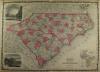 |
USA: North – South Carolina: Johnsons North and South Carolina. Kolorierte Lithografie bei Johnson und Ward in New York erschienen. Coloured lithograph published by Johnson and Ward in New York, 1864. 42,5 x 60 cm inkl. Bordüre. Gut erhalten. | 120,-- | |
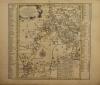 |
Borna: Colditz: Geithain: Laußig: Altenburg: Sachsen: Schenk Peter: Accurate Geogr. Delineation des zu den Leipziger Creisse gehörigen Ammtes Borna nebst andern angrenzenden Aemtern … Altkolorierter Kupferstich von P. Schenk d.J., dat. 1758. 45 x 49 cm. Wenige Gebrauchsspuren, sonst gut erhalten. good condition | 160,-- | |
 |
Deutschland: Militärkarte: Römisches Reich: Chatelain. Carte du Gouvernement Militaire de l Empire, ou on fait connoitre la Puissnce de … Kupferstich bei Henri Abraham Chatelain in Amsterdam, 1708. 47 x 62 cm. Gut erhalten. | 120,-- | |
 |
Grimma: Sachsen: Accurate geographische Delineation derer zu dem Leipziger Creisse gehörigen Aemmter Grimma und Mutzschen, nebst andern angrentzenden … Grenzkolorierter Kupferstich, Peter Schenk Jun., Amsterdam, 1753. 44,5 x 50,5 cm. Gut erhalten. in very good condition. | 170,-- | |
 |
Hessen: Osthessen: Bistum Fulda: Ohne Titel. Kolorierter Kupferstich bei Homann erschienen, um 1730. 37 x 51 cm. Etwas fleckig, sonst gut erhalten. | 100,-- | |
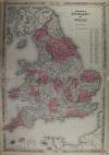 |
England: Wales: Johnsons England and Wales. Kolorierte Lithografie bei Johnson und Ward in New York erschienen. Coloured lithograph published by Johnson and Ward in New York, 1864. Bildformat: 63 x 42,5 inkl. Bordüre. Gut erhalten. | 120,-- | |
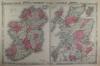 |
Ireland: Scottland: Ireland. Scotland. Kolorierte Lithografie bei Johnson und Ward in New York erschienen. Coloured lithograph published by Johnson and Ward in New York, 1864. Bildformat: 61,5 x 40 cm inkl. Bordüre. Gut erhalten. | 140,-- | |
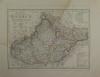 |
Mähren: Weiland. Die Markgrafschaft Mähren nebst Oesterreichisch Schlesien. Kupferstich nach Carl Ferdinand Weiland, 1839 datiert. 27 x 37,5 cm. 39,5 x 47 cm. Wasserrandig, wenige Stockflecken, sonst gut erhalten. | 50,-- | |
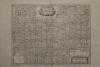 |
Trient: Fürstentum: Territorium Tridentinum. Kupferstich bei Janssonius- Waesberge erschienen, um 1680. 37 x 48 cm. Blattformat: 51 x 65 cm. Gut erhalten. | 230,-- | |
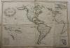 |
Amerika: America: Karibik: Cook: Amerika. Mit den neuesten Entdeckungen und Cooks Reisen. Grenzkolorierter Kupferstich bei Tranquillo Mollo in Wien erschienen, um 1820. 52 x 76 cm. Mehrmals gefaltet gewesen, einige Flecken, Gebrauchsspuren, sonst gut erhalten. | 320,-- | |
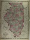 |
Illinois: USA: Johnson´s Illinois. Kolorierte Lithografie bei Johnson und Ward in New York erschienen. Coloured lithograph published by Johnson and Ward in New York, 1864. Blattformat: 66,5 x 46 cm. Gut erhalten. | 120,-- | |
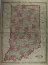 |
Indiana: USA: Johnsons Indiana. Kolorierte Lithografie bei Johnson und Ward in New York erschienen. Coloured lithograph published by Johnson and Ward in New York, 1864. Blattformat: 67 x 46 cm. Gut erhalten. | 150,-- | |
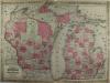 |
Michigan: Wisconsin: USA: Johnson´s Michigan and Wisconsin. Kolorierte Lithografie bei Johnson und Ward in New York erschienen. Coloured lithograph published by Johnson and Ward in New York, 1864. Blattformat: 46 x 67,5 cm. Gut erhalten. | 120,-- | |
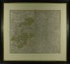 |
Sachsen: Thüringen: Homann: Circuli supe. Saxoniae pars meridionalis. Kolorierter Kupferstich nach Zollmann und Zürner, bei Homann Erben erschienen, 1757. 48 x 55 cm. Mit Rahmen 72 x 79 cm. Unter säurefreiem Passepartout und Rahmen. Gut erhalten. | 220,-- | |
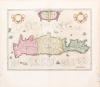 |
Griechenland: Kreta: Blaeu. Candia olim Creta Altkolorierter Kupferstich von W. Blaeu, um 1630. Old coloured copperplate engraving by W. Blaeu, around 1630. 38 : 52,5 cm. Blattformat: 54,5 : 61,3 cm. Wurmspuren im äußersten Rand. Die Karte ist insgesamt gut erhalten. Zacharakis/Scutari 386/247; Koeman II, 7900:2. | 850,-- | |
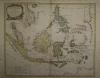 |
Südostasien: Southeast Asia: ARCHIPEL DES INDES ORIENTALES, qui comprend LES ISLES DE LA SONDE, MOLUQUES et PHILIPPINES. Kolorierter Kupferstich bei Robert de Vaugondy erschienen, datiert 1750. 48 x 59 cm. Stockfleckig. | 380,-- | |
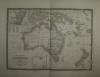 |
Australien: CARTE GÉNÉRALE DE L´AUSTRALIE … Grenzkolorierter Stahlstich nach Adrian-Hubert Brué bei Barthelemier in Paris, 1858. 36,4 x 50,6 cm Ansicht. 52 x 70 cm Blatt. Prima erhalten. | 200,-- | |
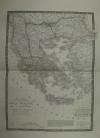 |
Südosteuropa: Griechenland: CARTE GÉNÉRALE de la TURQUIE D´EUROPE. Grenzkolorierter Stahlstich nach Adrian-Hubert Brué bei Barthelemier in Paris, 1858. 50,5 x 36,4 cm Karte. 70 x 52 cm Blatt. Gut erhalten. | 180,-- | |
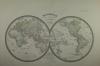 |
Weltkarte: 2 Hemisphären: MAPPEMONDE en deux Hemisphéres. Grenzkolorierter Stahlstich nach Adrian-Hubert Brué bei Barthelemier in Paris, 1858. 28 x 53 cm Ansicht. 52 x 70 cm Blatt. Gut erhalten. | 250,-- | |
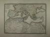 |
Europa: Nordafrika: Mittelmeeranrainerstaaten: CARTE GENERALE DES ETATS DU NORD DE L´AFRIQUE, de la MER MEDITERRANÉE et DE L´EUROPE MERIDIONALE. Grenzkolorierter Stahlstich nach Adrian-Hubert Brué bei Barthelemier in Paris, 1858. 36 x 50,7 cm. 52 x 70 cm. Einige Stockflecken, sonst gut erhalten. | 180,-- | |
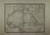 |
Nordafrika: Kaiserreich Abessinien: CARTE DÉTAILLÉE en deux feuilles DE L´AFRIQUE et des ILLES QUI EN DEPENDENT Grenzkolorierter Stahlstich nach Adrian-Hubert Brué bei Barthelemier in Paris, 1858. 36 x 50,5 cm Karte. 52 x 70 cm Blatt. Gut erhalten. | 100,-- | |
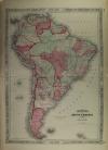 |
Südamerika: South America: Johnsons South America. Kolorierte Lithografie bei Johnson und Ward in New York erschienen. Coloured lithograph published by Johnson and Ward in New York, 1864. Bildformat: 56,5 x 40,5 cm. Blattformat: 67 x 40,5 cm. Gut erhalten. | 200,-- | |
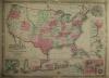 |
USA: Map: Military: Johnson´s New Military Map of the United States. Showing the Forts, Military Posts & c. with … Kolorierte Lithografie bei Johnson und Ward in New York erschienen. Coloured lithograph published by Johnson and Ward in New York, 1864. 44 x 60,5 cm inkl Bordüre. Gut erhalten. | 220,-- | |
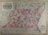 |
USA: Maryland: Delaware: Maryland: Johnson´s Virginia Delaware and Maryland. Kolorierte Lithografie bei Johnson und Ward in New York erschienen. Coloured lithograph published by Johnson and Ward in New York, 1864. 44,5 x 61 cm inkl. Bordüre. Gut erhalten. | 180,-- | |
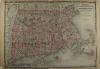 |
USA: Massachusetts Connecticut: Rhode Island: Johnsons Massachusetts Connecticut and Rhode Island. Kolorierte Lithografie bei Johnson und Ward in New York erschienen. Coloured lithograph published by Johnson and Ward in New York, 1864. 44 x 61 cm. Blattformat: 46 x 67 cm. Gut erhalten. | 180,-- | |
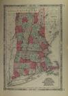 |
USA: Vermont: New Hampshire: Rhode Island: Johnsons Vermont, New Hampshire, Massachusetts, Rhode Island, and Connecticut. Kolorierte Lithografie bei Johnson und Ward in New York erschienen. Coloured lithograph published by Johnson and Ward in New York, 1864. 37 x 54 cm. Blattformat: 45,5 x 67 cm. Zwei hinterlegte Einrisse. Sonst gut erhalten. | 200,-- | |
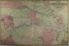 |
USA: Vicinity of Richmond: Peninsular Campaign in Virginia: Johnsons Map of The Vicinity of Richmond, Peninsular Campaign in Virginia. Kolorierte Lithografie bei Johnson und Ward in New York erschienen. Coloured lithograph published by Johnson and Ward in New York, 1864. 45 x 67 cm. Etwas knaprandig, sonst gut erhalten. | 180,-- | |
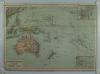 |
Australien: Polynesien: Südpazifik: Australien und Polynesien. Chromolithografie um 1900, bei Frytag und Berndt in Wien erschienen. 34 x 47,8 cm. Gut erhalten. | 40,-- | |
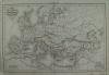 |
Europa. Carte de L´Europe L´Empire des Huns. Grenzkolorierter Stahlstich, Delamarche 1839. 29 x 43 cm. Etwas fingerfleckig, sonst gut erhalten. | 50,-- | |
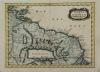 |
Amazonas Mündung: Suriname: Guyana: Golf von Paria: GUIANA in GUIANAM & CARIBANAM divisa. Kolorierter Kupferstich, Nicolas Sanson um 1690. 20 x 27 cm. Rechts am Rand ein 2,5 cm kleiner Einriß, hinterlegt mit reparaturband. Insgesamt gut erhalten. | 75,-- | |
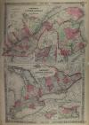 |
Canada: Johnson´s Lower Canada and New Brunswick – Upper Canada. Kolorierte Lithografie bei Johnson und Ward in New York erschienen. Coloured lithograph published by Johnson and Ward in New York, 1864. Bildformat: 61 x 40 cm. Gut erhalten. | 140,-- | |
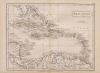 |
Karibik: West Indies: West Indies. Kupferstich von Hall, aus Samuel Butlers „Atlas of modern geography“, 1836. 18,2 x 23,7 cm. Gut erhalten. | 50,-- | |
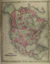 |
North America: Mexico: Johnsons North America. Kolorierte Lithografie bei Johnson und Ward in New York erschienen. Colored lithograph published by Johnson and Ward in New York, 1864. 56 x 43,5 cm inkl. Bordüre. Wenig fleckig, Mittelfaz links und rechts je 3 cm hinterlegt, sonst gut erhalten. A little bit stained, centrefacet backed 3 cm each left and right, otherwise well preserved. | 200,-- | |
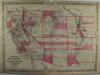 |
USA: Südwesten der Vereinigten Staaten: Southwest America: Johnsons California, with territories of Utha, Nevada, Colorado, New Mexico and Arizona. Kolorierte Lithografie bei Johnson und Ward in New York erschienen. Coloured lithograph published by Johnson and Ward in New York, 1864. 43 x 59,5 cm inkl. Bordüre. Unten 2 Flecken, links im Bild senkrechte Knickfalte, sonst gut erhalten. 2 stains at lower margin, vertical crease at left side of image, otherwise well preserved. | 220,-- | |
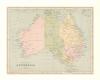 |
Australien: General Map of Australia. Stahlstich von W. Hughes, 1875. 18,6 x 24 cm, wenige Stockflecken am Rand, sonst gut erhalten. | 50,-- | |
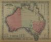 |
Australien: Australia: Johnsons Australia. Kolorierte Lithografie bei Johnson und Ward in New York erschienen. Coloured lithograph published by Johnson and Ward in New York, 1864. 32 x 39,5 cm. Blattformat: 35,5 x 45,4 cm. Gut erhalten. | 200,-- | |
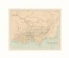 |
Australien: Victoria: Victoria. Stahlstich von W. Hughes, 1875. 18,8 x 23,5 cm, minimale Stockflecken, sonst gut erhalten. | 50,-- | |
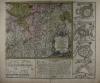 |
Deutschland: Rheinkarte: Oettinger. Charte Geographique de la Campagne du Haut Rhin … Kolorierter Kupferstich von Johann Friedrich Oettinger bei Matthäus Seutter in Augsburg erschienen, um 1740. 49,3 x 58 cm. Mittelfalz unten ca. 5 cm aufgeplatzt, etwas fleckig. Insgesamt gut erhalten. | 300,-- | |
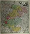 |
Ober- und Mittelfranken: Franken: Frankenland: Circuli Franconiae pars orientalis et potior novissime delineata. Altkolorierter Kupferstich bei Johann B. Homann, mit Privileg, nach 1729 erschienen. 55 x 48,6 cm. Am Rand Stockflecken und etwas Wasserrandig, sonst gut erhalten. | 250,-- | |
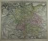 |
Postroutenkarte: Postal route map: Homann. Neu-vermehrte Post-Charte durch gantz Teutschland nach Italien, Franckreich, Niederland, Preußen, Polen, und Ungarn ec. Altkolorierter Kupferstich nach Johann Peter Nell bei Johann Baptist Homann in Nürnberg, nach 1729 da mit Privileg. Old coloured copper engraving after Johann Peter Nell by Johann Baptist Homann in Nuremberg, after 1729 da mit Privileg. 46,3 x 58 cm. Mittelfalz restauriert, unten einige Einriße allesamt hinterlegt. Sonst prima erhalten. Centrefold restored, some tears at lower margin all backed. Otherwise well preserved. | 400,-- | |
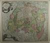 |
Schwaben: S.R.I. Circulus Sueviae continens Ducatum Wirtenbergensem. altkolorierter Kupferstich bei Joahnn B. Homann, mit Druckprivileg. nach 1729. 48,5 x 55,2 cm. Breitrandiges Blatt, wenige Flecken mit schönem Kolorit, gut erhalten. | 340,-- | |
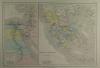 |
Altes Griechenland: Ägypten: Grèce Ancienne.Égypte Ancienne. Kolorierter Stahlstich von Jenotte nach Drioux und Leroy, 1874. 29,5 x 43 cm. Gut erhalten. | 40,-- | |
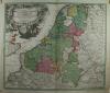 |
Benelux: Netherlands: Homann. Tabula Generalis Totius Belgii qua Provinciae XVII. Infer. Germaniae … altkolorierter Kupferstich bei Johann B. Homann in Nürnberg erschienen, mit Druckprivileg, nach 1729. Old coloured copper engraving published by Johann B. Homann in Nuremberg, with printing privilege, after 1729. 47,5 x 56 cm. Wenige Gebrauchsspuren, sonst prima erhalten. Few signs of wear, otherwise in good condition. | 350,-- | |
 |
Böhmen: Das Königreich Böhmen. Stahlstich nach Gräf im Geografischen Institut in Weimar erschienen, 1857. 49 x 60 cm. Gut erhalten. | 60,-- | |
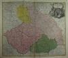 |
Böhmen: Schlesien: Mähren: Lausitz: Regni Bohemiae Ducatus Silesiae Marchiona-tus Moraviae et Lusatiae Tabula Generalis, altkolorierter Kupferstich bei Homann, ca. 1730. 48 x 57 cm, unten Bug und Einriß fachmännisch restauriert. Oben am Rand wenig wasserrandig, sonst gut erhalten. | 330,-- | |
 |
Europa: Carte de L´Europe Dans son État Actuel … Grenzkolorierter Stahlstich bei Andriveau-Goujon in Paris, datiert 1850. 38,5 x 49,7 cm, unten in der Mittelfalz Einriß von 3 cm, sonst prima erhalten. | 220,-- | |
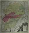 |
Frankreich: Burgund: Homann. Comitatus Burgundiae tam in Primaris Ejus … altkolorierter Kupferstich bei Johann B. Homann in Nürnberg erschienen, mit Druckprivileg, nach 1729. 56 x 47,5 cm. Die Mittelfalz ist etwas Leimschattig, am rechten Rand Wasserrandig, sonst gut erhalten mit kräftigem Kolorit und schöne Titelkartusche. | 250,-- | |
 |
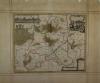
Frankreich: France: Homann: Totius Regn Galliae sive Franciae tabula … kolorierter Kupferstich bei Johann B. Homann, mit Druckprivileg, nach 1729 erschienen. Coloured copper engraving by Johann B. Homann, with printing privilege, published after 1729. 48,5 x 56, 5 cm. Ein Einriß und die Mittelfalz fachmännisch restauriert, gut erhalten. One tear and the centrefold expertly restored, well preserved. | 230,-- | |
 |
Niederschlesien: Liegnitz: Janssonius- van Waesbergen. Ducatus Silesiae Ligniciensis. Altkolorierter Kupferstich bei Janssonius – Waesbergen & Moses Pitt, um 1700. 39 x 47 cm. Mittelfalz wurde retauriert, am rand fleckig, sonst gut erhalten. | 250,-- | |
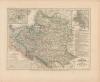 |
Polen: Die Republik Polen nach ihrem Bestande im Jahre 1772 und das Königreich Polen seit dem Jahre 1815. Grenzkolorierter Stahlstich bei Joseph Meyer um 1850. 18,5 x 25 cm, am Rand einige Stockflecken, sonst gut erhalten. | 60,-- | |
 |
Polen: Ohne Titel. Stahlstich bei Flemming in Glogau erschienen, ca. 1870. 23,5 x 34 cm. Knapprandig und stockfleckig. | 35,-- | |
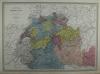 |
Schweiz: Dyonnet. Suisse et Nord de L´Italie. Kolorierter Stahlstich von Dyonnet nach Dufour bei Pilon in Paris, 1858. 55 x 75 cm, gut erhalten. | 180,-- | |
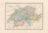 |
Schweiz: Jacobs. Suisse. Kolorierte Lithografie von Jacobs nach Fremin, Paris 1850. 21,4 x 30 cm, gut erhalten. | 50,-- | |
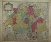 |
Schweiz: Lotter Tobias, Novisima et Accuratissima Helvetiae Rhaetiae, Valesiae et Partis Sabaudiae … Kolorierter Kupferstich bei Tobias Conrad Lotter, nach 1757. 49 x 57 cm. Insgesamt etwas flau und Wasserrandig. Ritter – Die Welt aus Augsburg Seite 49. | 250,-- | |
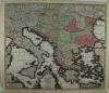 |
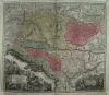
Südosteuropa: Adriaküste: Rumänien: Griechenland: Seutter. Theatrum belli sive novissima tabula qua maxima pars Danubii et præsertim Hungaria cum aliis adiacentibus regnis; nec non Græcia, Morea, et Archipelagi insulæ accurate delineantur Excusa et venalis exposita À Matthaeo Seutter. Altkolorierter Kupferstich von Matthäus Seutter, um 1730. 49,5 x 58 cm. Die Mittelfalz leicht leimschattig, sonst sehr gut erhalten. Deutscher Kunstverlag „Die Welt aus Augsburg“ | 450,-- | |
 |
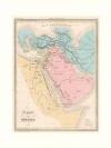
Ungarn: Südosteuropa: Seutter. Novißima et accuratißima Hungariae cum circumjacentibus Regnis et Principatibus in mappa Geographica Designatio … Altkolorierter Kupferstich von Matthäus Seutter, nach 1741. 50 x 58 cm, gut erhalten. Deutscher Kunstverlag „Die Welt aus Augsburg“ | 500,-- | |
 |
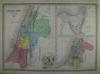
Der Weg der Hebräer: Géographie DES Hébreux. Farblithografie nach Bellier, Paris 1850. 29,5 x 23 cm. Gut erhalten. | 60,-- | |
 |
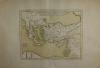
Heiliges Land: Israel: Palästina: Dyonnet. Géographie Sacrée. Kolorierter Stahlstich von Dyonnet nach Dufour bei Pilon in Paris, um 1858. 55 x 75 cm, Mittelfalz und daneben Einriß von ca. 4 cm, sonst gut erhalten. | 180,-- | |
 |
Türkei: Syrien: Griechenland: Delisle. Tabula Geographica Provinciarum et Urbium. Kupferstich von Guillaume Delisle bei Phillipe Buache, 1745 datiert, erschienen 1776. 33,5 x 41,5 cm, gut erhalten. | 200,-- | |
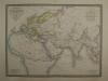 |
Alte Welt: Carte Générale du Monde Ancien … Grenzkolorierter Stahlstich bei Andriveau-Goujon, datiert 1859. 38,2 x 51 cm. 38 x 51 cm. minimale Stockflecken, sonst gut erhalten. | 210,-- | |
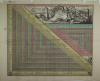 |
Meilenzeiger: Lotter. Germaniae Aliorumque Quorundam Loco-rum Europae Poliometria. Altkolorierter Kupferstich bei Tobias C. Lotter, um 1760 in Augsburg erschienen. 46 x 55 cm. einige Flecken, Gebrauchspuren und Knickfalten, sonst gut erhalten. Schönes Kolorit. | 400,-- | |
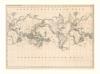 |
Weltkarte: ohne Titel. Lithografie nach K.F.V. Hoffmann, ca. 1840. 24 x 34,3 cm, Knickfalten da aus einem Buch. | 60,-- | |
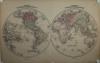 |
Weltkarte in zwei Hemisphären: Johnson´s Western Hemisphere – Eastern Hemisphere. Kolorierte Lithografie bei Johnson und Ward in New York erschienen. Coloured lithograph published by Johnson and Ward in New York, 1864. 34 x 67 cm. Die Mittelfalz wurde fachmännisch restauriert. Gut erhalten. | 250,-- | |
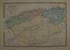 |
Algerien: Carte de L´Algérie Comprenaut … Grenzkolorierter Stahlstich von Lemercier bei J. Andriveau-Goujon in Paris, datiert 1855. 41 x 59 cm, prima erhalten. | 150,-- | |
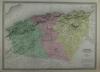 |
Algerien: Dyonnet. Algérie Dressée par A.H. Dufour. Kolorierter Stahlstich von Dyonnet nach Dufour bei Pilon in Paris, um 1858. 55 x 75 cm, Prima erhalten. | 180,-- | |
 |
Algerien: North-Africa or Barbary II Algier. Stahlstich von Walker bei Baldwin & Cradock, datiert 1834. 31 x 39 cm. Patina, wenige Gebrauchsspuren, gut erhalten. | 50,-- | |
 |
Algerien: Tunesien: Algérie et états de tunis. Kolorierter Stahlstich von Jenotte nach Drioux & Leroy, 1874. 29 x 41,5 cm, einige kleine Flecken sonst gut erhalten. | 60,-- | |
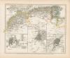 |
Nordafrika: Marocco: Algier: Marocco, Algier und Tunis 1849. Grenzkolorierter Stahlstich nach Radefeld bei Joseph Meyer, 1849 datiert. 21 x 26,2 cm, gut erhalten. | 45,-- | |
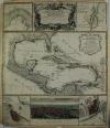 |
Mexico: Karibik: Central America: Mappa Geographica complectens I. India occidentalis partem mediam circvm Isthmvm Panamensem … Grenzkolor. Kupferstich nach d´Anville bei Homanns Erben in Nürnberg, um 1740. Datiert mit 1731. Border col. Engraving after d’Anville by Homann’s heirs in Nuremberg, c. 1740. Dated 1731. 57 x 48,5 cm. Am Rand etwas Wasserrandig und einige Stockflecken, sonst gut erhalten. At the edge a little bit waterstained at margins and some foxing, otherwise well preserved. | 900,-- | |
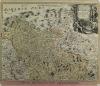 |
Mähren: Tschechien: Homann. Marchionatus Moraviae Circulus Brunnensis quem…, Altkolorierter Kupferstich nach Johann Chr. Müller bei Johann B. Homann, um 1720. 47,5 x 60 cm. Prima erhalten. | 250,-- | |
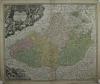 |
Mähren: Tschechien: Homann. Tabula Generalis Marchionatus Moraviae in sex Circulos … Kolorierter Kupferstich nach Johann Christoph Müller bei Johann Bap. Homann, um 1720-1729. 48,5 x 58 cm. Am Rand etwas fleckig bzw. angestaubt, sonst gut erhalten. | 240,-- | |
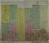 |
Römisches Reich: Deutschland: Homann. Orbis in Tabula Pars Secunda … Kolorierter Kupferstich bei Homann Erben erschienen, 1753. 48 x 57,5 cm. Stock und Wasserfleckig. | 50,-- | |
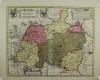 |
Schlesien: Schweidnitz: Kühnow. Ducatus Silesiae Schwidnicensis. Altkolorierter Kupferstich nach Friedrich Kühnow bei Peter Schenk und Gerad Valk, um 1700. 41 x 51 cm. Gut erhalten, schönes Kolorit. | 400,-- | |
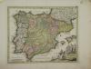 |
Spanien: Spain: Portugal: „Hispaniae et Portugaliae Regna“ Kupferstich bei Christian Weigel, 1718. Weigel/Köhler, 27 x 34 cm, wenig fleckig, sonst gut erhalten. Un poco manchado, por lo demás en buen estado. Joh. David Köhler Bequemer Schul = und Reisen = Atlas | 250,-- | |
 |
Südsee: Australien: Seerouten: Cook: Charte von einem Theile des Süd=Meeres, darinnen die verschiedenen Fahrten und Entdeckungen angezeigt sind, welche von nachstehenden, auf Sr. Gros=Britt.Maj. Befehl ausgesandten Schiffen gemacht worden sind. Kupferstich von Christian Benjamin Glassbach, um 1791. 35 x 65,2 cm. Gereinigt, gut erhalten. | 480,-- | |
 |
Afrika: Angola: Gabun: Reinecke. Charte von Niederguinea und den angrenzenden Ländern Süd Afrikas…, grenzkolorierter Kupferstich nach J. C. M. Reinecke beim Industrie Comtoir in Weimar, 1801. 42,7 x 47,5 cm. Gut erhalten, breitrandig. | 170,-- | |
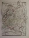 |
Russland: Polen: Poland. Russia: Carte generale de la Russie d’ Europe, du Royaume de Pologne. Grenzkolorierter Stahlstich nach Adrian-Hubert Brué bei Barthelemier in Paris, 1858. 50,5 x 36 cm. Blattformat: 52, x 70 cm. Wenige Stockflecken, sonst gut erhalten. | 100,-- | |
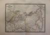 |
Russland: Russia: Carte de la Russie d´Asie. Grenzkolorierter Stahlstich nach Adrian-Hubert Brué bei Barthelemier in Paris, 1858. 36 x 50,5 cm. Blattformat: 52, x 70 cm. Prima erhalten. | 100,-- | |
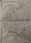 |
Russland: Russia: Carte de la Russie d´Europe. Stahlstich von Delamarche, datiert 1838. 41 x 29 cm. Wenig fleckig, sonst gut erhalten. | 75,-- | |
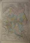 |
Russland: Russia: Russie d´Europe. Kolorierte Lithografie nach Jenotte bei Belin in Paris erschienen, 1861. 43,5 x 29,2 cm. Mittelfalz links und rechts gelöst, sonst gut erhalten. | 45,-- | |
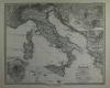 |
Itaien: Italien im Maassstabe von 1:3.700.000. Stahlstich von Stier nach Habenicht, 1877. 33 x 41 cm, gut erhalten. | 80,-- | |
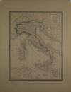 |
Italien: Andriveau – Goujon, Carte De L´ Italie Ancienne et… , altgrenzkolorierter Stahlstich bei J. Andriveau-Goujon in Paris, datiert 1845. 49,3 x 38,2 cm. Gut erhalten. | 180,-- | |
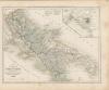 |
Italien: Das Königreich beider Sicilien Nördliche Haelfte. Abruzzo, Terra di Lavoro. Apulien und Calabrien 1849. Grenzkolorierter Stahlstich bei Joseph Meyer, um 1850. 21 x 27 cm, meist am Rand etwas fleckig, sonst gut erhalten. | 45,-- | |
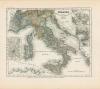 |
Italien: Italien mit der Dalmat.– Albanesischen Küste. Grenzkolorierter Stahlstich nach Rohde im Bibliographischen Institut erschienen, datiert 1852. 19 x 23,3 cm, prima Zustand. | 60,-- | |
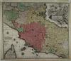 |
Italien: Seutter, Matthäus. Novissima et accuratissima Delineatio Status Ecclesiae et, altkolorierter Kupferstich von Matthäus Seutter, 1735 in Augsburg erschien. 49,5 x 57 cm. Oben am Rand Wurmfraß, unten etwas fleckig, sonst prima erhalten. | 350,-- | |
 |
Italien: Piemont- Savoyen: Regiae celsitudinis Sabaudicae Status in quo Ducatus Sabaudiae, Principatus Pedemontium ut Ducatus Montisferrati. altkolorierter Kupferstich bei Johann B. Homann, nach 1729. 50 x 57 cm. Am Rand einige Stockflecken, sonst gut erhalten. | 280,-- | |
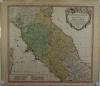 |
Italien: Toskana: Homann Erben. Status Ecclesiastici nec non Magni Ducatus Toscanae, kolorierter Kupferstich bei Homann Erben, 1748. 48 x 53 cm Stockfleckig, neben der Mittelfalz weitere Knickfalte. | 250,-- | |
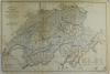 |
Schweiz: Carte Physique et Routiére de la Suisse, A Map of Switzerland. Stahlstich bei T. Starling in London, datiert 1836. 31 x 48 cm. nicht gut. Siehe Bild. | 30,-- | |
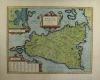 |
Sizilien: Sicilia: Sicilae Veteris Typus Amstelodami Apud Joannen Janssonium. Kolorierter Kupferstich von A. Goos nach A. Ortelius bei Janssonius erschienen, um 1641-1650. 38 x 48 cm. 48,5 x 59 cm. Das Kolorit ist neu, einige restaurierte Einriße am Rand. Insgesamt prima erhalten. Broecke Nr. 211. | 600,-- | |
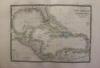 |
Karibik: Caribbean: Carte des Iles Antilles, … Grenzkolorierter Stahlstich nach Adrian-Hubert Brué bei Barthelemier in Paris, 1858. 36,5 x 51 cm. 52, x 69 cm. Gut erhalten. | 200,-- | |
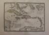 |
Karibik: Karibische Inseln: Caribbean Sea: Carte Particuliere Isles Antilles ou des Indes Occidentales. Grenzkolorierter Stahlstich nach Adrian-Hubert Brué bei Barthelemier in Paris, 1858. 36 x 50,5 cm. Blattformat: 52 x 70 cm. Prima erhalten. | 200,-- | |
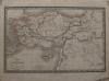 |
Türkei: Anatolien: Syrien: Carte de L´Asie Mineure et des Contrées. Stahlstich nach Reichard, um 1860. 26 x 40,5 cm. Einige Flecken, sonst gut erhalten. | 30,-- | |
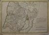 |
Heiliges Land: Israel: Palästina: Holy Land: Terrae Sanctae Tabula. Kupferstich, Delisle, um 1782. 34,5 x 49,5 cm. Blattformat: 38 x 52 cm. Stockfleckig, Blatt zwei, unten links ein kleines Loch, sonst gut erhalten. | 220,-- | |
 |
Ägypten: Aegyptus Antiqua Mandato Serenissimi Delphini Publici Juris Facta. Kupferstich nach D´Anville, bei Laurie und Whittle 1812 in London erschienen. 48,2 x 31,2 cm. Oben und unten einige kleine Einriße, sonst gut erhalten. | 120,-- | |
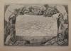 |
Algerien: ALGERIE, COLONIE FRANCAISE. Stahlstich nach A.M. Perrot, um 1850. 29 x 42,7 cm. Blattformat: 36 x 51 cm. Gut erhalten. | 85,-- | |
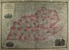 |
USA: Kentucky: Tennessee: Johnson´s Kentucky and Tennessee. Kolorierte Lithografie bei Johnson und Ward in New York erschienen. Coloured lithograph published by Johnson and Ward in New York, 1864. 43 x 61 cm inkl. Bordüre. Gut erhalten. | 180,-- | |
|
Einträge 101–199 von 199
Zurück · Vor
|
|||
| Seite: 1 · 2 |
Sortiert nach: Autor · Titel · Katalogsortierung · Erscheinungsjahr · Preis · Letzte Änderung · Relevanz
HescomShop - Das Webshopsystem für Antiquariate und Verlage | © 2006-2026 by HESCOM-Software. Alle Rechte vorbehalten.