
Landkarten
Die Liste enthält 198 Einträge. Suchergebnisse löschen und Gesamtbestand anzeigen.
| Abbildung |
Beschreibung Stichwort, Autor, Titel, Buchbeschreibung |
Preis EUR |
|
|---|---|---|---|
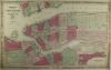 |
USA: New York: Johnsons Map of New York and the adjacent cities. Kolorierte Lithografie bei Johnson und Ward in New York erschienen. Coloured lithograph published by Johnson and Ward in New York, 1864. 41 x 66 cm. Blattformat: 45 x 67 cm. Prima erhalten. | 220,-- |  |
 |
Amerika: Homann: Totius Americae Septentrionalis et Meridionalis novissima repraesentatio. Altkolorierter Kupferstich bei J.B Homann, nach 1729 da mit Druckprivileg. Old coloured copper engraving by J.B Homann, after 1729 with in Druckprivileg. 48,5 x 56,5 cm. Insgesamt gut erhalten. Unten am Rand 3 hinterlegte Einriße, rechts in der Ecke ein Wasserfleck. Mittelfalz wurde fachmännisch geglättet. Overall well preserved. 3 backed tears at lower margin, a water stain in the right corner. Centrefold has been professionally smoothed. | 750,-- | |
 |
Südliches Afrika: AFRIQUE MÉRIDIONALE. Grenzkolorierter Stahlstich nach Adrian-Hubert Brué bei Barthelemier in Paris, 1858. 36,5 x 50,6 cm Karte. 52 x 70 cm Blatt. Prima erhalten. | 200,-- | |
 |
Naher Osten: Ägypten: Palästina: Lower Egypt and the Adjacent Deserts, with a Part of Palestine: Grenzkolorierter Kupferstich nach Louis S. Delarochette bei Wybl, 1802. 53,5 x 74 cm, prima erhalten. | 150,-- | |
 |
Afrika: Senegal: Gambia: Karte von den Senegal Ländern. Grenzkolorierter Kupferstich von Theodor Friedr. Ehrmann nach Spezialkarten von Poirson u. Blanchot, 1803. 44 x 58,1cm, breitrandig, gut erhalten. | 200,-- | |
 |
Afrika: L AFRIQUE divisee suivant L estendue de ses principales parties. Grenzkolorierter Kupferstich von Hubert Jaillot bei P. Mortier erschienen, 1696-1708. Border coloured copperplate engraving by Hubert Jaillot published by P. Mortier, 1696-1708. 54 x 87,5. Blattformat: 63 x 98,5 cm. Insgesamt gut erhalten. Sonst etwas gebräunt & einige Stockflecken. 2 schwache Knickfalten. Betz Arfica – Map 156.4 | 900,-- | |
 |
Skandinavien: Scandinavia: Scandinavia complectens Suecia, Daniae & Norvegiae Regna ex Tabulis. altkolorierter Kupferstich bei Johann B. Homann, nach 1729. Old coloured copper engraving by Johann B. Homann, after 1729. 48,4 x 56,8 cm. Unten Mittelfalz restauriert, links davon restaurierter Einriß von 3,5 cm. Sonst gut erhalten mit schönem Kolorit. Lower centrefold restored, left of it restored tear of 3,5 cm. Otherwise well preserved with beautiful colouring. | 380,-- | |
 |
Bremen: Karte: Verden: Homann. Ducatus Bremae et Ferdae Nova Tabula edita. Kolorierter Kupferstich, Homann nach 1729 erschienen. 48,5 x 56,5 cm. Blattformat 54, 62,5 cm. Gut erhalten. | 200,-- | |
 |
Deutschland: Landkarte: Johnson´s Germany. Kolorierte Lithografie bei Johnson und Ward in New York erschienen. Coloured lithograph published by Johnson and Ward in New York, 1864. Bildformat: 61 x 39,5 cm. Gut erhalten. | 120,-- | |
 |
Schönburg: Grafschaft: Comitatvs Schoenburgensis. Kolorierter Kupferstich von Sebastian Dorn? nach Johann Paul Trenckmann bei Homann Erben erschienen, datiert 1760. 47 x 46,5 cm. Blattformat: 53 x 52 cm. Gut erhalten. | 250,-- | |
|
Einträge 71–80 von 198
|
|||
Sortiert nach: Autor · Titel · Katalogsortierung · Erscheinungsjahr · Preis · Letzte Änderung · Relevanz
HescomShop - Das Webshopsystem für Antiquariate und Verlage | © 2006-2026 by HESCOM-Software. Alle Rechte vorbehalten.