
Maps
Die Liste enthält 143 Einträge. Suchergebnisse löschen und Gesamtbestand anzeigen.
| Abbildung |
Beschreibung Stichwort, Autor, Titel, Buchbeschreibung |
Preis EUR |
|
|---|---|---|---|
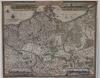 |
Brandenburg: Mecklenburg: Pommern: Tabula Electoratus Brandenburgici, Meckelenburgi et Maximae Partis Pomeraniae. Kolorierter Kupferstich von Abraham Goos bei Claes Jansz. Visscher in Amsterdam, datiert 1633. Blattformat: 45 x 55 cm. Karte links und rechts angerändert, wenige restaurierte Stellen. Sonst gut erhalten. | 850,-- |  |
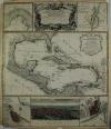 |
Mexico: Karibik: Central America: Mappa Geographica complectens I. India occidentalis partem mediam circvm Isthmvm Panamensem … Grenzkolor. Kupferstich nach d´Anville bei Homanns Erben in Nürnberg, um 1740. Datiert mit 1731. Border col. Engraving after d’Anville by Homann’s heirs in Nuremberg, c. 1740. Dated 1731. 57 x 48,5 cm. Am Rand etwas Wasserrandig und einige Stockflecken, sonst gut erhalten. At the edge a little bit waterstained at margins and some foxing, otherwise well preserved. | 900,-- | |
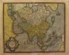 |
Asien: Asia: Mercartor. Asia ex magna orbis terre descriptione. Altkol. Kupferstich-Karte von G. Mercator junior, 1613-1630. 37,5 47 cm. Gleichmäßige Patina und lichtrandig. Hinterlegter Einriss von ca. 20 cm. Der Zustand ist im Preis mit berücksichtigt. Even patina and light-stained. Backed tear of approx. 20 cm. The condition is included in the price. | 1.200,-- | |
|
Einträge 141–143 von 143
Zurück · Vor
|
|||
Sortiert nach: Autor · Titel · Katalogsortierung · Erscheinungsjahr · Preis · Letzte Änderung · Relevanz
HescomShop - Das Webshopsystem für Antiquariate und Verlage | © 2006-2026 by HESCOM-Software. Alle Rechte vorbehalten.